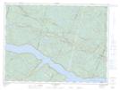
Maps showing La Truite, Mont-Valin; Le Fjord-du-Saguenay, Quebec
La Truite is a River feature located in Mont-Valin; Le Fjord-du-Saguenay, Quebec.
- Latitude: 48° 23' 49'' North (decimal: 48.3969719)
- Longitude: 70° 14' 33'' West (decimal: -70.2425626)
- Topography Feature Category: River feature
- Geographical Feature: Fosse à saumon
- Canadian Province/Territory: Quebec
- Location: Mont-Valin; Le Fjord-du-Saguenay
- Atlas of Canada Locator Map: La Truite
- GPS Coordinate Locator Map: La Truite Lat/Long
La Truite NTS Map Sheets