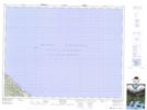
Maps showing L'Échouerie, Gaspé; La Côte-de-Gaspé, Quebec
L'Échouerie is a Unincorporated area located in Gaspé; La Côte-de-Gaspé, Quebec.
- Latitude: 49° 3' 22'' North (decimal: 49.0561651)
- Longitude: 64° 29' 6'' West (decimal: -64.4848818)
- Topography Feature Category: Unincorporated area
- Geographical Feature: Village
- Canadian Province/Territory: Quebec
- Location: Gaspé; La Côte-de-Gaspé
- GPS Coordinate Locator Map: L'Échouerie Lat/Long
L'Échouerie NTS Map Sheets