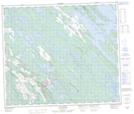
Maps showing Burnt Creek, Lac-Vacher; Caniapiscau, Quebec
Burnt Creek is a Unincorporated area located in Lac-Vacher; Caniapiscau, Quebec and has an elevation of 577 meters.
- Latitude: 54° 48' 43'' North (decimal: 54.8120590)
- Longitude: 66° 53' 3'' West (decimal: -66.8842624)
- Topography Feature Category: Unincorporated area
- Geographical Feature: Hameau
- Canadian Province/Territory: Quebec
- Elevation: 577 meters
- Location: Lac-Vacher; Caniapiscau
- Atlas of Canada Locator Map: Burnt Creek
- GPS Coordinate Locator Map: Burnt Creek Lat/Long
Burnt Creek NTS Map Sheets