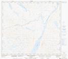
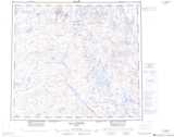
Maps showing Lac Katakutawachitich, Rivière-Koksoak; Kativik, Quebec
Lac Katakutawachitich is a Lake located in Rivière-Koksoak; Kativik, Quebec.
- Latitude: 56° 41' 54'' North (decimal: 56.6984694)
- Longitude: 69° 22' 44'' West (decimal: -69.3788013)
- Topography Feature Category: Lake
- Geographical Feature: Lac
- Canadian Province/Territory: Quebec
- Location: Rivière-Koksoak; Kativik
- Atlas of Canada Locator Map: Lac Katakutawachitich
- GPS Coordinate Locator Map: Lac Katakutawachitich Lat/Long
Lac Katakutawachitich NTS Map Sheets