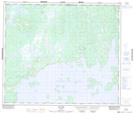
Maps showing Pointe Kausapachuun, Caniapiscau; Caniapiscau, Quebec
Pointe Kausapachuun is a Cape located in Caniapiscau; Caniapiscau, Quebec and has an elevation of 484 meters.
- Latitude: 54° 58' 51'' North (decimal: 54.9808333)
- Longitude: 69° 50' 3'' West (decimal: -69.8341667)
- Topography Feature Category: Cape
- Geographical Feature: Pointe
- Canadian Province/Territory: Quebec
- Elevation: 484 meters
- Location: Caniapiscau; Caniapiscau
- Atlas of Canada Locator Map: Pointe Kausapachuun
- GPS Coordinate Locator Map: Pointe Kausapachuun Lat/Long
Pointe Kausapachuun NTS Map Sheets