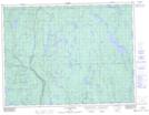
Maps showing Montagne du Cap, Rivière-Mistassini; Maria-Chapdelaine, Quebec
Montagne du Cap is a Mountain located in Rivière-Mistassini; Maria-Chapdelaine, Quebec and has an elevation of 386 meters.
- Latitude: 49° 16' 27'' North (decimal: 49.2741667)
- Longitude: 73° 11' 9'' West (decimal: -73.1858333)
- Topography Feature Category: Mountain
- Geographical Feature: Mont
- Canadian Province/Territory: Quebec
- Elevation: 386 meters
- Location: Rivière-Mistassini; Maria-Chapdelaine
- Atlas of Canada Locator Map: Montagne du Cap
- GPS Coordinate Locator Map: Montagne du Cap Lat/Long
Montagne du Cap NTS Map Sheets