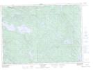
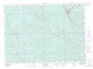
Maps showing Kipawa, Kipawa; Témiscamingue, Quebec
Kipawa is a Village located in Kipawa; Témiscamingue, Quebec and has an elevation of 288 meters.
- Latitude: 46° 47' North (decimal: 46.7833333)
- Longitude: 78° 59' West (decimal: -78.9833333)
- Topography Feature Category: Village
- Geographical Feature: Municipalité
- Canadian Province/Territory: Quebec
- Elevation: 288 meters
- Location: Kipawa; Témiscamingue
- Atlas of Canada Locator Map: Kipawa
- GPS Coordinate Locator Map: Kipawa Lat/Long
Kipawa NTS Map Sheets