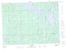
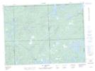
Maps showing Landanet, Rouyn-Noranda; Rouyn-Noranda, Quebec
Landanet is a Geographical area located in Rouyn-Noranda; Rouyn-Noranda, Quebec.
- Latitude: 47° 47' North (decimal: 47.7832999)
- Longitude: 78° 20' West (decimal: -78.3332999)
- Topography Feature Category: Geographical area
- Geographical Feature: Canton
- Canadian Province/Territory: Quebec
- Location: Rouyn-Noranda; Rouyn-Noranda
- GPS Coordinate Locator Map: Landanet Lat/Long
Landanet NTS Map Sheets