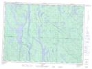
Maps showing Colline Misamikwiwicik, Rivière-Kipawa; Témiscamingue, Quebec
Colline Misamikwiwicik is a Mountain located in Rivière-Kipawa; Témiscamingue, Quebec.
- Latitude: 46° 55' 1'' North (decimal: 46.9169444)
- Longitude: 77° 53' 51'' West (decimal: -77.8975)
- Topography Feature Category: Mountain
- Geographical Feature: Colline
- Canadian Province/Territory: Quebec
- Location: Rivière-Kipawa; Témiscamingue
- Atlas of Canada Locator Map: Colline Misamikwiwicik
- GPS Coordinate Locator Map: Colline Misamikwiwicik Lat/Long
Colline Misamikwiwicik NTS Map Sheets