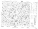
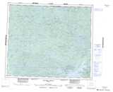
Maps showing Auchistikunapasunanuch, Baie-James; Jamésie, Quebec
Auchistikunapasunanuch is a Unincorporated area located in Baie-James; Jamésie, Quebec.
- Latitude: 54° 52' 42'' North (decimal: 54.8783333)
- Longitude: 77° 51' 57'' West (decimal: -77.8658333)
- Topography Feature Category: Unincorporated area
- Geographical Feature: Lieu-dit
- Canadian Province/Territory: Quebec
- Location: Baie-James; Jamésie
- Atlas of Canada Locator Map: Auchistikunapasunanuch
- GPS Coordinate Locator Map: Auchistikunapasunanuch Lat/Long
Auchistikunapasunanuch NTS Map Sheets