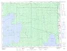
Maps showing Branche Aumont, La Reine; Abitibi-Ouest, Quebec
Branche Aumont is a River located in La Reine; Abitibi-Ouest, Quebec.
- Latitude: 48° 56' 13'' North (decimal: 48.9370379)
- Longitude: 79° 30' 30'' West (decimal: -79.5084420)
- Topography Feature Category: River
- Geographical Feature: Ruisseau
- Canadian Province/Territory: Quebec
- Location: La Reine; Abitibi-Ouest
- Atlas of Canada Locator Map: Branche Aumont
- GPS Coordinate Locator Map: Branche Aumont Lat/Long
Branche Aumont NTS Map Sheets