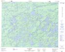
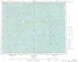
Maps showing Lac Kapekutapustech, Baie-James; Jamésie, Quebec
Lac Kapekutapustech is a Lake located in Baie-James; Jamésie, Quebec.
- Latitude: 51° 54' 1'' North (decimal: 51.9003774)
- Longitude: 75° 47' 29'' West (decimal: -75.7913615)
- Topography Feature Category: Lake
- Geographical Feature: Lac
- Canadian Province/Territory: Quebec
- Location: Baie-James; Jamésie
- Atlas of Canada Locator Map: Lac Kapekutapustech
- GPS Coordinate Locator Map: Lac Kapekutapustech Lat/Long
Lac Kapekutapustech NTS Map Sheets