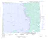
Maps showing Rivière Kapikwaucikastikw, Baie-James; Jamésie, Quebec
Rivière Kapikwaucikastikw is a River located in Baie-James; Jamésie, Quebec.
- Latitude: 52° 38' 32'' North (decimal: 52.6422222)
- Longitude: 78° 29' 4'' West (decimal: -78.4844444)
- Topography Feature Category: River
- Geographical Feature: Rivière
- Canadian Province/Territory: Quebec
- Location: Baie-James; Jamésie
- Atlas of Canada Locator Map: Rivière Kapikwaucikastikw
- GPS Coordinate Locator Map: Rivière Kapikwaucikastikw Lat/Long