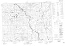
Maps showing Île Kistabish, Baie-James; Jamésie, Quebec
Île Kistabish is a Island located in Baie-James; Jamésie, Quebec.
- Latitude: 49° 25' 26'' North (decimal: 49.4238889)
- Longitude: 78° 15' 35'' West (decimal: -78.2597222)
- Topography Feature Category: Island
- Geographical Feature: Île / Ile
- Canadian Province/Territory: Quebec
- Location: Baie-James; Jamésie
- Atlas of Canada Locator Map: Île Kistabish
- GPS Coordinate Locator Map: Île Kistabish Lat/Long
Île Kistabish NTS Map Sheets