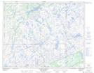
Maps showing Lac Bread, Côte-Nord-du-Golfe-du-Saint-Laurent; Basse-Côte-Nord, Quebec
Lac Bread is a Lake located in Côte-Nord-du-Golfe-du-Saint-Laurent; Basse-Côte-Nord, Quebec.
- Latitude: 51° 34' 43'' North (decimal: 51.5786633)
- Longitude: 57° 24' 36'' West (decimal: -57.4099002)
- Topography Feature Category: Lake
- Geographical Feature: Lac
- Canadian Province/Territory: Quebec
- Location: Côte-Nord-du-Golfe-du-Saint-Laurent; Basse-Côte-Nord
- Atlas of Canada Locator Map: Lac Bread
- GPS Coordinate Locator Map: Lac Bread Lat/Long
Lac Bread NTS Map Sheets