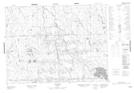
Maps showing Cours d'eau Goulet, Val-Saint-Gilles; Abitibi-Ouest, Quebec
Cours d'eau Goulet is a River located in Val-Saint-Gilles; Abitibi-Ouest, Quebec.
- Latitude: 49° 0' 6'' North (decimal: 49.0017585)
- Longitude: 79° 7' 27'' West (decimal: -79.1242592)
- Topography Feature Category: River
- Geographical Feature: Cours d'eau agricole
- Canadian Province/Territory: Quebec
- Location: Val-Saint-Gilles; Abitibi-Ouest
- Atlas of Canada Locator Map: Cours d'eau Goulet
- GPS Coordinate Locator Map: Cours d'eau Goulet Lat/Long
Cours d'eau Goulet NTS Map Sheets