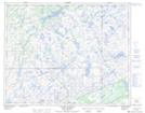
Maps showing Colline Leg, Petit-Mécatina; Minganie, Quebec
Colline Leg is a Mountain located in Petit-Mécatina; Minganie, Quebec.
- Latitude: 51° 42' 53'' North (decimal: 51.7147734)
- Longitude: 57° 14' 22'' West (decimal: -57.2393367)
- Topography Feature Category: Mountain
- Geographical Feature: Colline
- Canadian Province/Territory: Quebec
- Location: Petit-Mécatina; Minganie
- Atlas of Canada Locator Map: Colline Leg
- GPS Coordinate Locator Map: Colline Leg Lat/Long
Colline Leg NTS Map Sheets