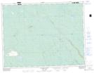
Maps showing Rapide Pagidahagan, Baie-James; Jamésie, Quebec
Rapide Pagidahagan is a Rapids located in Baie-James; Jamésie, Quebec and has an elevation of 248 meters.
- Latitude: 49° 46' 11'' North (decimal: 49.7697222)
- Longitude: 78° 33' 55'' West (decimal: -78.5652778)
- Topography Feature Category: Rapids
- Geographical Feature: Rapide
- Canadian Province/Territory: Quebec
- Elevation: 248 meters
- Location: Baie-James; Jamésie
- Atlas of Canada Locator Map: Rapide Pagidahagan
- GPS Coordinate Locator Map: Rapide Pagidahagan Lat/Long
Rapide Pagidahagan NTS Map Sheets