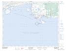
Maps showing Pointe au Petit Havre, Blanc-Sablon; Basse-Côte-Nord, Quebec
Pointe au Petit Havre is a Cape located in Blanc-Sablon; Basse-Côte-Nord, Quebec and has an elevation of 8 meters.
- Latitude: 51° 24' 30'' North (decimal: 51.4083856)
- Longitude: 57° 11' 35'' West (decimal: -57.1929519)
- Topography Feature Category: Cape
- Geographical Feature: Pointe
- Canadian Province/Territory: Quebec
- Elevation: 8 meters
- Location: Blanc-Sablon; Basse-Côte-Nord
- Atlas of Canada Locator Map: Pointe au Petit Havre
- GPS Coordinate Locator Map: Pointe au Petit Havre Lat/Long
Pointe au Petit Havre NTS Map Sheets