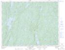
Maps showing Île à Pierre, Rivière-aux-Outardes; Manicouagan, Quebec
Île à Pierre is a Island located in Rivière-aux-Outardes; Manicouagan, Quebec.
- Latitude: 50° 7' 9'' North (decimal: 50.1191667)
- Longitude: 68° 26' 40'' West (decimal: -68.4444444)
- Topography Feature Category: Island
- Geographical Feature: Île / Ile
- Canadian Province/Territory: Quebec
- Location: Rivière-aux-Outardes; Manicouagan
- Atlas of Canada Locator Map: Île à Pierre
- GPS Coordinate Locator Map: Île à Pierre Lat/Long
Île à Pierre NTS Map Sheets