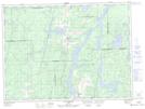
Maps showing Ruisseau du Rang Double, Rémigny; Témiscamingue, Quebec
Ruisseau du Rang Double is a River located in Rémigny; Témiscamingue, Quebec.
- Latitude: 47° 45' 23'' North (decimal: 47.7563889)
- Longitude: 79° 11' 40'' West (decimal: -79.1944444)
- Topography Feature Category: River
- Geographical Feature: Ruisseau
- Canadian Province/Territory: Quebec
- Location: Rémigny; Témiscamingue
- Atlas of Canada Locator Map: Ruisseau du Rang Double
- GPS Coordinate Locator Map: Ruisseau du Rang Double Lat/Long
Ruisseau du Rang Double NTS Map Sheets