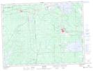
Maps showing Cours d'eau Venne, Malartic; Vallée-de-l'Or, Quebec
Cours d'eau Venne is a River located in Malartic; Vallée-de-l'Or, Quebec.
- Latitude: 48° 14' 11'' North (decimal: 48.2364804)
- Longitude: 78° 9' 17'' West (decimal: -78.1547691)
- Topography Feature Category: River
- Geographical Feature: Cours d'eau agricole
- Canadian Province/Territory: Quebec
- Location: Malartic; Vallée-de-l'Or
- Atlas of Canada Locator Map: Cours d'eau Venne
- GPS Coordinate Locator Map: Cours d'eau Venne Lat/Long
Cours d'eau Venne NTS Map Sheets