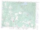
Maps showing Embranchement Majella, Saint-Ambroise; Le Fjord-du-Saguenay, Quebec
Embranchement Majella is a River located in Saint-Ambroise; Le Fjord-du-Saguenay, Quebec.
- Latitude: 48° 38' 22'' North (decimal: 48.6394444)
- Longitude: 71° 23' 52'' West (decimal: -71.3977778)
- Topography Feature Category: River
- Geographical Feature: Cours d'eau agricole
- Canadian Province/Territory: Quebec
- Location: Saint-Ambroise; Le Fjord-du-Saguenay
- Atlas of Canada Locator Map: Embranchement Majella
- GPS Coordinate Locator Map: Embranchement Majella Lat/Long
Embranchement Majella NTS Map Sheets