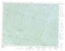
Maps showing Décharge du Lac Miller, Saint-Fulgence; Le Fjord-du-Saguenay, Quebec
Décharge du Lac Miller is a River located in Saint-Fulgence; Le Fjord-du-Saguenay, Quebec.
- Latitude: 48° 31' 1'' North (decimal: 48.5169444)
- Longitude: 70° 54' 32'' West (decimal: -70.9088889)
- Topography Feature Category: River
- Geographical Feature: Ruisseau
- Canadian Province/Territory: Quebec
- Location: Saint-Fulgence; Le Fjord-du-Saguenay
- Atlas of Canada Locator Map: Décharge du Lac Miller
- GPS Coordinate Locator Map: Décharge du Lac Miller Lat/Long
Décharge du Lac Miller NTS Map Sheets