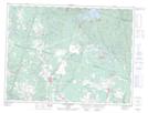
Maps showing Embranchement Girard, Labrecque; Lac-Saint-Jean-Est, Quebec
Embranchement Girard is a River located in Labrecque; Lac-Saint-Jean-Est, Quebec.
- Latitude: 48° 42' 19'' North (decimal: 48.7052778)
- Longitude: 71° 27' 8'' West (decimal: -71.4522222)
- Topography Feature Category: River
- Geographical Feature: Cours d'eau agricole
- Canadian Province/Territory: Quebec
- Location: Labrecque; Lac-Saint-Jean-Est
- Atlas of Canada Locator Map: Embranchement Girard
- GPS Coordinate Locator Map: Embranchement Girard Lat/Long
Embranchement Girard NTS Map Sheets