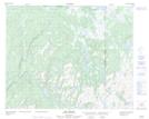
Maps showing Colline Deux Milles, Petit-Mécatina;Minganie, Quebec
Colline Deux Milles is a Mountain located in Petit-Mécatina;Minganie, Quebec.
- Latitude: 51° 49' 50'' North (decimal: 51.8306059)
- Longitude: 57° 13' 2'' West (decimal: -57.2171114)
- Topography Feature Category: Mountain
- Geographical Feature: Colline
- Canadian Province/Territory: Quebec
- Location: Petit-Mécatina;Minganie
- Atlas of Canada Locator Map: Colline Deux Milles
- GPS Coordinate Locator Map: Colline Deux Milles Lat/Long
Colline Deux Milles NTS Map Sheets