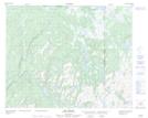
Maps showing Marécages Indian Pond, Petit-Mécatina; Minganie, Quebec
Marécages Indian Pond is a Low vegetation located in Petit-Mécatina; Minganie, Quebec.
- Latitude: 51° 58' 57'' North (decimal: 51.9825491)
- Longitude: 57° 8' 5'' West (decimal: -57.1346086)
- Topography Feature Category: Low vegetation
- Geographical Feature: Marécages
- Canadian Province/Territory: Quebec
- Location: Petit-Mécatina; Minganie
- Atlas of Canada Locator Map: Marécages Indian Pond
- GPS Coordinate Locator Map: Marécages Indian Pond Lat/Long
Marécages Indian Pond NTS Map Sheets