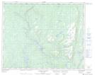
Maps showing Lacs à la Tente, Petit-Mécatina; Minganie, Quebec
Lacs à la Tente is a Lake located in Petit-Mécatina; Minganie, Quebec.
- Latitude: 51° 50' 1'' North (decimal: 51.8336647)
- Longitude: 57° 36' 56'' West (decimal: -57.6154587)
- Topography Feature Category: Lake
- Geographical Feature: Lacs
- Canadian Province/Territory: Quebec
- Location: Petit-Mécatina; Minganie
- Atlas of Canada Locator Map: Lacs à la Tente
- GPS Coordinate Locator Map: Lacs à la Tente Lat/Long
Lacs à la Tente NTS Map Sheets