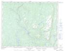
Maps showing Lucky Brook Ground, Petit-Mécatina; Minganie, Quebec
Lucky Brook Ground is a Unincorporated area located in Petit-Mécatina; Minganie, Quebec.
- Latitude: 51° 52' 11'' North (decimal: 51.8697762)
- Longitude: 57° 47' 36'' West (decimal: -57.7932381)
- Topography Feature Category: Unincorporated area
- Geographical Feature: Lieu-dit
- Canadian Province/Territory: Quebec
- Location: Petit-Mécatina; Minganie
- Atlas of Canada Locator Map: Lucky Brook Ground
- GPS Coordinate Locator Map: Lucky Brook Ground Lat/Long
Lucky Brook Ground NTS Map Sheets