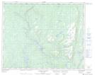
Maps showing Lac Chapeau, Petit-Mécatina; Minganie, Quebec
Lac Chapeau is a Lake located in Petit-Mécatina; Minganie, Quebec.
- Latitude: 51° 53' 24'' North (decimal: 51.8900537)
- Longitude: 57° 38' 17'' West (decimal: -57.6379582)
- Topography Feature Category: Lake
- Geographical Feature: Lac
- Canadian Province/Territory: Quebec
- Location: Petit-Mécatina; Minganie
- Atlas of Canada Locator Map: Lac Chapeau
- GPS Coordinate Locator Map: Lac Chapeau Lat/Long
Lac Chapeau NTS Map Sheets