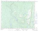
Maps showing Îlot Fly, Petit-Mécatina; Minganie, Quebec
Îlot Fly is a Island located in Petit-Mécatina; Minganie, Quebec.
- Latitude: 51° 47' 40'' North (decimal: 51.7944975)
- Longitude: 57° 41' 9'' West (decimal: -57.6857373)
- Topography Feature Category: Island
- Geographical Feature: Îlot / Ilot
- Canadian Province/Territory: Quebec
- Location: Petit-Mécatina; Minganie
- Atlas of Canada Locator Map: Îlot Fly
- GPS Coordinate Locator Map: Îlot Fly Lat/Long
Îlot Fly NTS Map Sheets