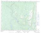
Maps showing Île Bear, Petit-Mécatina; Minganie, Quebec
Île Bear is a Island located in Petit-Mécatina; Minganie, Quebec.
- Latitude: 51° 49' 50'' North (decimal: 51.8306091)
- Longitude: 57° 45' 46'' West (decimal: -57.7626826)
- Topography Feature Category: Island
- Geographical Feature: Île / Ile
- Canadian Province/Territory: Quebec
- Location: Petit-Mécatina; Minganie
- Atlas of Canada Locator Map: Île Bear
- GPS Coordinate Locator Map: Île Bear Lat/Long
Île Bear NTS Map Sheets