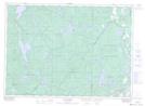
Maps showing Val-Guertin, Messines; La Vallée-de-la-Gatineau, Quebec
Val-Guertin is a Unincorporated area located in Messines; La Vallée-de-la-Gatineau, Quebec and has an elevation of 183 meters.
- Latitude: 46° 16' 49'' North (decimal: 46.2802778)
- Longitude: 75° 59' 41'' West (decimal: -75.9947221)
- Topography Feature Category: Unincorporated area
- Geographical Feature: Secteur résidentiel
- Canadian Province/Territory: Quebec
- Elevation: 183 meters
- Location: Messines; La Vallée-de-la-Gatineau
- Atlas of Canada Locator Map: Val-Guertin
- GPS Coordinate Locator Map: Val-Guertin Lat/Long
Val-Guertin NTS Map Sheets