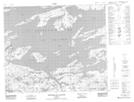
Maps showing Centrale LG-Quatre, Baie-James; Jamésie, Quebec
Centrale LG-Quatre is a Hydraulic construction located in Baie-James; Jamésie, Quebec and has an elevation of 338 meters.
- Latitude: 53° 53' 12'' North (decimal: 53.8867915)
- Longitude: 73° 27' 53'' West (decimal: -73.4648547)
- Topography Feature Category: Hydraulic construction
- Geographical Feature: Centrale hydroélectrique
- Canadian Province/Territory: Quebec
- Elevation: 338 meters
- Location: Baie-James; Jamésie
- Atlas of Canada Locator Map: Centrale LG-Quatre
- GPS Coordinate Locator Map: Centrale LG-Quatre Lat/Long
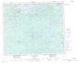
Centrale LG-Quatre NTS Map Sheets