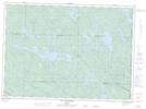
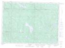
Maps showing Baie du Landing, Lac-Nilgaut; Pontiac, Quebec
Baie du Landing is a Bay located in Lac-Nilgaut; Pontiac, Quebec.
- Latitude: 46° 30' 13'' North (decimal: 46.5036111)
- Longitude: 77° 15' 2'' West (decimal: -77.2505555)
- Topography Feature Category: Bay
- Geographical Feature: Baie
- Canadian Province/Territory: Quebec
- Location: Lac-Nilgaut; Pontiac
- Atlas of Canada Locator Map: Baie du Landing
- GPS Coordinate Locator Map: Baie du Landing Lat/Long
Baie du Landing NTS Map Sheets