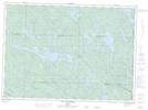
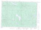
Maps showing Lac à Jean, Lac-Nilgaut; Pontiac, Quebec
Lac à Jean is a Lake located in Lac-Nilgaut; Pontiac, Quebec.
- Latitude: 46° 29' 40'' North (decimal: 46.4945030)
- Longitude: 77° 16' 18'' West (decimal: -77.2716775)
- Topography Feature Category: Lake
- Geographical Feature: Étang
- Canadian Province/Territory: Quebec
- Location: Lac-Nilgaut; Pontiac
- Atlas of Canada Locator Map: Lac à Jean
- GPS Coordinate Locator Map: Lac à Jean Lat/Long
Lac à Jean NTS Map Sheets