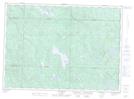
Maps showing Cours d'eau Desjardins, Chute-Saint-Philippe; Antoine-Labelle, Quebec
Cours d'eau Desjardins is a River located in Chute-Saint-Philippe; Antoine-Labelle, Quebec and has an elevation of 255 meters.
- Latitude: 46° 39' 2'' North (decimal: 46.6505556)
- Longitude: 75° 15' 52'' West (decimal: -75.2644444)
- Topography Feature Category: River
- Geographical Feature: Cours d'eau agricole
- Canadian Province/Territory: Quebec
- Elevation: 255 meters
- Location: Chute-Saint-Philippe; Antoine-Labelle
- Atlas of Canada Locator Map: Cours d'eau Desjardins
- GPS Coordinate Locator Map: Cours d'eau Desjardins Lat/Long
Cours d'eau Desjardins NTS Map Sheets