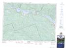
Maps showing Lac Ames, Rapides-des-Joachims; Pontiac, Quebec
Lac Ames is a Lake located in Rapides-des-Joachims; Pontiac, Quebec and has an elevation of 320 meters.
- Latitude: 46° 14' 7'' North (decimal: 46.2353374)
- Longitude: 77° 39' 52'' West (decimal: -77.6644718)
- Topography Feature Category: Lake
- Geographical Feature: Étang
- Canadian Province/Territory: Quebec
- Elevation: 320 meters
- Location: Rapides-des-Joachims; Pontiac
- Atlas of Canada Locator Map: Lac Ames
- GPS Coordinate Locator Map: Lac Ames Lat/Long
Lac Ames NTS Map Sheets