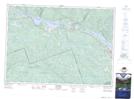
Maps showing Lac Lessing, Rapides-des-Joachims; Pontiac, Quebec
Lac Lessing is a Lake located in Rapides-des-Joachims; Pontiac, Quebec and has an elevation of 296 meters.
- Latitude: 46° 14' 59'' North (decimal: 46.2497817)
- Longitude: 77° 37' 16'' West (decimal: -77.6211368)
- Topography Feature Category: Lake
- Geographical Feature: Lac
- Canadian Province/Territory: Quebec
- Elevation: 296 meters
- Location: Rapides-des-Joachims; Pontiac
- Atlas of Canada Locator Map: Lac Lessing
- GPS Coordinate Locator Map: Lac Lessing Lat/Long
Lac Lessing NTS Map Sheets