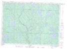
Maps showing Lac Ehrhart, Lac-Nilgaut; Pontiac, Quebec
Lac Ehrhart is a Lake located in Lac-Nilgaut; Pontiac, Quebec and has an elevation of 365 meters.
- Latitude: 46° 29' 59'' North (decimal: 46.4997820)
- Longitude: 77° 36' 25'' West (decimal: -77.6069682)
- Topography Feature Category: Lake
- Geographical Feature: Lac
- Canadian Province/Territory: Quebec
- Elevation: 365 meters
- Location: Lac-Nilgaut; Pontiac
- Atlas of Canada Locator Map: Lac Ehrhart
- GPS Coordinate Locator Map: Lac Ehrhart Lat/Long
Lac Ehrhart NTS Map Sheets