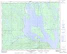
Maps showing Centrale Hart-Jaune, Rivière-Mouchalagane; Caniapiscau, Quebec
Centrale Hart-Jaune is a Hydraulic construction located in Rivière-Mouchalagane; Caniapiscau, Quebec.
- Latitude: 51° 47' 6'' North (decimal: 51.7850627)
- Longitude: 67° 54' 44'' West (decimal: -67.9121915)
- Topography Feature Category: Hydraulic construction
- Geographical Feature: Centrale hydroélectrique
- Canadian Province/Territory: Quebec
- Location: Rivière-Mouchalagane; Caniapiscau
- GPS Coordinate Locator Map: Centrale Hart-Jaune Lat/Long
Centrale Hart-Jaune NTS Map Sheets