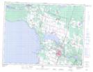
Maps showing Île aux Bouleaux, Alma; Lac-Saint-Jean-Est, Quebec
Île aux Bouleaux is a Island located in Alma; Lac-Saint-Jean-Est, Quebec.
- Latitude: 48° 36' 51'' North (decimal: 48.6142136)
- Longitude: 71° 42' 42'' West (decimal: -71.7117742)
- Topography Feature Category: Island
- Geographical Feature: Île / Ile
- Canadian Province/Territory: Quebec
- Location: Alma; Lac-Saint-Jean-Est
- Atlas of Canada Locator Map: Île aux Bouleaux
- GPS Coordinate Locator Map: Île aux Bouleaux Lat/Long