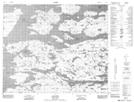
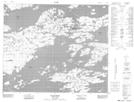
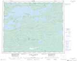
Maps showing Lac Apitukamach, Baie-James; Jamésie, Quebec
Lac Apitukamach is a Lake located in Baie-James; Jamésie, Quebec.
- Latitude: 53° 35' 7'' North (decimal: 53.5852778)
- Longitude: 75° 28' 48'' West (decimal: -75.48)
- Topography Feature Category: Lake
- Geographical Feature: Partie de réservoir
- Canadian Province/Territory: Quebec
- Location: Baie-James; Jamésie
- Atlas of Canada Locator Map: Lac Apitukamach
- GPS Coordinate Locator Map: Lac Apitukamach Lat/Long
Lac Apitukamach NTS Map Sheets