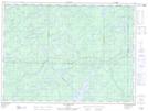
Maps showing Étang de l'Abattis, Lac-Moselle; La Vallée-de-la-Gatineau, Quebec
Étang de l'Abattis is a Lake located in Lac-Moselle; La Vallée-de-la-Gatineau, Quebec.
- Latitude: 47° 47' 41'' North (decimal: 47.7947222)
- Longitude: 75° 51' 25'' West (decimal: -75.8569444)
- Topography Feature Category: Lake
- Geographical Feature: Étang
- Canadian Province/Territory: Quebec
- Location: Lac-Moselle; La Vallée-de-la-Gatineau
- Atlas of Canada Locator Map: Étang de l'Abattis
- GPS Coordinate Locator Map: Étang de l'Abattis Lat/Long
Étang de l'Abattis NTS Map Sheets