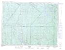
Maps showing Ferland-et-Boilleau, Ferland-et-Boilleau; Le Fjord-du-Saguenay, Quebec
Ferland-et-Boilleau is a Unincorporated area located in Ferland-et-Boilleau; Le Fjord-du-Saguenay, Quebec.
- Latitude: 48° 10' 58'' North (decimal: 48.1828141)
- Longitude: 70° 50' 42'' West (decimal: -70.8450831)
- Topography Feature Category: Unincorporated area
- Geographical Feature: Bureau de poste
- Canadian Province/Territory: Quebec
- Location: Ferland-et-Boilleau; Le Fjord-du-Saguenay
- Atlas of Canada Locator Map: Ferland-et-Boilleau
- GPS Coordinate Locator Map: Ferland-et-Boilleau Lat/Long