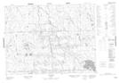
Maps showing Villebois, Baie-James; Jamésie, Quebec
Villebois is a Unincorporated area located in Baie-James; Jamésie, Quebec.
- Latitude: 49° 5' 44'' North (decimal: 49.0956469)
- Longitude: 79° 8' 47'' West (decimal: -79.1464813)
- Topography Feature Category: Unincorporated area
- Geographical Feature: Bureau de poste
- Canadian Province/Territory: Quebec
- Location: Baie-James; Jamésie
- Atlas of Canada Locator Map: Villebois
- GPS Coordinate Locator Map: Villebois Lat/Long