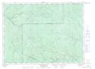
Maps showing Coulée Creuse, Lejeune; Témiscouata, Quebec
Coulée Creuse is a Valley located in Lejeune; Témiscouata, Quebec.
- Latitude: 47° 49' 41'' North (decimal: 47.8280555)
- Longitude: 68° 25' 43'' West (decimal: -68.4286111)
- Topography Feature Category: Valley
- Geographical Feature: Ravin
- Canadian Province/Territory: Quebec
- Location: Lejeune; Témiscouata
- Atlas of Canada Locator Map: Coulée Creuse
- GPS Coordinate Locator Map: Coulée Creuse Lat/Long
Coulée Creuse NTS Map Sheets