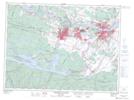
Maps showing Sainte-Claire, Saguenay; Saguenay, Quebec
Sainte-Claire is a Geographical area located in Saguenay; Saguenay, Quebec.
- Latitude: 48° 26' 46'' North (decimal: 48.4461111)
- Longitude: 71° 5' 26'' West (decimal: -71.0905556)
- Topography Feature Category: Geographical area
- Geographical Feature: Paroisse
- Canadian Province/Territory: Quebec
- Location: Saguenay; Saguenay
- Atlas of Canada Locator Map: Sainte-Claire
- GPS Coordinate Locator Map: Sainte-Claire Lat/Long
Sainte-Claire NTS Map Sheets