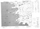
Maps showing Pointe d'Aiguebelle, Baie-James; Jamésie, Quebec
Pointe d'Aiguebelle is a Cape located in Baie-James; Jamésie, Quebec.
- Latitude: 52° 31' 31'' North (decimal: 52.5252778)
- Longitude: 78° 42' 45'' West (decimal: -78.7125)
- Topography Feature Category: Cape
- Geographical Feature: Pointe
- Canadian Province/Territory: Quebec
- Location: Baie-James; Jamésie
- GPS Coordinate Locator Map: Pointe d'Aiguebelle Lat/Long
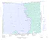
Pointe d'Aiguebelle NTS Map Sheets