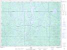
Maps showing Sainte-Thérèse-de-l'Enfant-Jésus, La Tuque; Le Haut-Saint-Maurice, Quebec
Sainte-Thérèse-de-l'Enfant-Jésus is a Geographical area located in La Tuque; Le Haut-Saint-Maurice, Quebec.
- Latitude: 48° 6' 30'' North (decimal: 48.1083333)
- Longitude: 75° 21' 29'' West (decimal: -75.3580556)
- Topography Feature Category: Geographical area
- Geographical Feature: Paroisse
- Canadian Province/Territory: Quebec
- Location: La Tuque; Le Haut-Saint-Maurice
- Atlas of Canada Locator Map: Sainte-Thérèse-de-l'Enfant-Jésus
- GPS Coordinate Locator Map: Sainte-Thérèse-de-l'Enfant-Jésus Lat/Long
Sainte-Thérèse-de-l'Enfant-Jésus NTS Map Sheets